
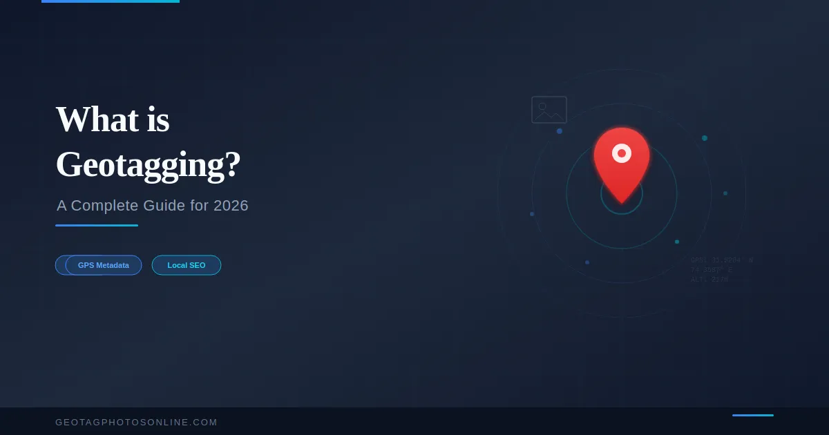
What is Geotagging? A Complete Guide for 2026
Geotagging is the process of adding geographic location data to a photo’s metadata. The location data includes latitude, longitude, and sometimes altitude. This data is stored inside the image file using the EXIF (Exchangeable Image File Format) standard. Search engines, mapping platforms, and photo management apps use this location data to organize, display, and rank images.
What Does Geotagging Mean?
Geotagging means embedding GPS coordinates into a digital file’s metadata. The term combines “geo” (Earth) and “tag” (label). A geotagged photo carries invisible location information that identifies where the image was captured or what location it represents.
The GPS coordinates are stored as latitude and longitude values inside the EXIF header of the image file. A geotagged JPEG file, for example, contains fields such as GPSLatitude, GPSLongitude, GPSLatitudeRef, and GPSLongitudeRef within its metadata structure.
How Does Geotagging Work?
Geotagging works by recording GPS satellite data at the moment a photo is taken. A GPS-enabled device such as a smartphone calculates its position using signals from multiple satellites. The device then writes the calculated latitude and longitude into the photo’s EXIF metadata automatically.
There are two methods to geotag a photo:
Automatic geotagging happens when a GPS-enabled camera or smartphone records the coordinates during capture. iPhones use a combination of GPS satellites, Wi-Fi positioning, and cell tower data. Android devices use similar methods with accuracy varying by chipset quality.
Manual geotagging involves adding GPS coordinates to a photo after it was taken. This is done through geotagging tools that let users select a location on a map and embed those coordinates into the image file. Manual geotagging is essential when the original photo has no location data or when the embedded location needs to change.
What is EXIF Data in a Photo?
EXIF data is metadata stored inside an image file. EXIF stands for Exchangeable Image File Format. Every digital photo contains EXIF data that records camera settings, date, time, resolution, and potentially GPS coordinates.
The key EXIF fields related to geotagging are:
GPSLatitude and GPSLongitude store the exact coordinates. GPSAltitude records the elevation. GPSDateStamp and GPSTimeStamp record when the location was captured. GPSImgDirection stores the compass direction the camera faced.
EXIF geotagging is standardized for JPEG files. HEIC, PNG, and WebP files can also store GPS data, but not all software can read geotags from these formats consistently.
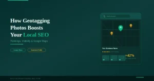
Why is Geotagging Important for Local SEO?
Geotagging is important for local SEO because it provides search engines with geographic context for images. Google processes EXIF metadata when images are uploaded to Google Business Profile. The embedded GPS coordinates reinforce the business location signal in Google’s ranking algorithm.
A business that uploads geotagged photos to its Google Business Profile strengthens its local relevance. The GPS data confirms the business operates at the claimed location. This additional location signal supports higher visibility in Google Maps and the local pack results.
Geotagged images also benefit website SEO. Google’s documentation on image metadata encourages enriching images with relevant metadata. Photos with GPS data embedded provide search engines with clearer context about the image content and its geographic relevance.
Who Uses Geotagging?
Business owners use geotagging to improve their Google Business Profile rankings. SEO agencies geotag client images in bulk to strengthen local search signals. Real estate professionals geotag property photos to associate listings with precise locations. Photographers use geotagging to organize libraries by location. Travel bloggers geotag images to map journeys and improve geographic relevance.
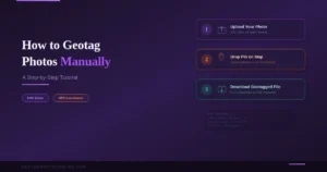
How to Geotag a Photo?
The simplest method is using an online geotagging tool. Upload the image, select a location on the map, and download the geotagged file. The tool writes GPS coordinates directly into the EXIF metadata.
The process takes three steps. Upload the photo. Set the target location by dropping a pin or entering coordinates. Download the processed image with embedded GPS data. For bulk geotagging, upload multiple images at once and apply coordinates to the entire batch.
Does Social Media Remove Geotags?
Yes. Most social media platforms strip EXIF metadata from uploaded images. Instagram, Facebook, WhatsApp, and Twitter remove GPS coordinates and other metadata during upload. This is a privacy protection measure.
Google Business Profile preserves EXIF metadata during upload. Uploading geotagged photos directly to Google Business Profile retains the embedded GPS data. Always upload the original geotagged file, not a version shared through messaging apps or social media.
What is the Difference Between Geotagging and Location Tagging?
Geotagging embeds GPS coordinates into a file’s metadata at the data level. The coordinates are invisible and travel with the file. Location tagging is a platform feature that adds a visible location label to a post or image within that specific platform.
Geotagging modifies the file itself. Location tagging modifies the platform listing. A geotagged photo carries its location data everywhere the file goes. A location-tagged Instagram post only shows the location on Instagram.
Does Geotagging Affect Privacy?
Geotagging can reveal the exact location where a photo was taken. Sharing geotagged images publicly can expose a home address or workplace. Removing EXIF metadata before sharing photos on public platforms is a recommended privacy practice.
GPS coordinates in photos are not visible when viewing the image normally. They are only accessible through file properties or metadata reading tools.
Geotagging connects photos to places. It serves photographers, businesses, and platforms that need geographic context for images. The process is simple, the impact on local SEO is measurable, and the tools to do it are freely available.
One Comment
Comments are closed.